| JOURNAL 2020 |
| North Craven Heritage Trust |
Dr David Johnson led a group of 17, including Bill’s daughter Janet and grand-daughter Rachel (Fig. 1). The walk supported the indefatigable work of Judy Rogers and the People and the Dales project (https://www.ydmt.org/what-we-do/people-and-the-dales) in extending enjoyment of the Dales to people from nearby urban areas: including those who suffer deprivation, disabled people, youngsters, refugees / asylum seekers and people with mental health issues.
We started at the Malham Tarn car park, where David explained the geological basis of the landscape, the effects of the formation of the Craven Faults, why Malham Tarn and Tarn Moss exist and how they have changed over the past 12,000 years; and where the water runs from the Moor. He suggested probable past levels of population and the farming activities they would have engaged in. These activities in monastic times led to serious disputes between monastic houses which required Papal adjudication, illustrating the high value of the grazing.
Moving onto Dean Moor we started to look for and at isolated settlements in which people might have lived from around 2,000 years ago (Fig. 2). We inspected a large isolated rock which illustrated the development of vegetation since the Ice Age - algae, lichen, moss, soil, grass, and lastly flowering plants - 10,000 years of biology on one stone! (Fig. 3).
Walking down Trougate we moved into a lower area of more intensive settlement, developed over 2,000 years or so. It included a large stockyard with a mediaeval dew-pond (Fig. 4). Turning up towards Malham Lings, we looked over the Craven basin and saw the changes in geology from the limestone of Malham Moor to the shale of Weets.
A gentle climb up Malham Lings took us through a monastic sheep farm, where upwards of 2,000 sheep were recorded as being looked after by five monastic servants, who milked them and made cheese in the summer. Below Torlery Edge we walked past the footings of a group of half a dozen houses which, if they had been occupied at the same time, would have made a little hamlet sheltered from the north but open to the south- west and with all-important water (often hard to find on the porous limestone) nearby.
We ended the 8 km walk with a puzzle - what was this stone with a rectangular hold cut into it? (Fig. 5). The answer took us back to the monastic disputes - this was the base for one of a series of great stone posts marking the boundary between Bolton Priory and Fountains Abbey lands.
Altogether a sociable day under big skies, with a backing chorus of lark song, in aid of a good cause, with a most knowledgeable guide (Fig. 6). A day in which we experienced time travel over 380 million years in 8 km - we hope a fitting memorial to the life, work and leadership of Bill Mitchell.
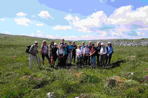
Figure 1.
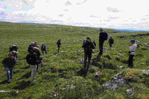
Figure 2.
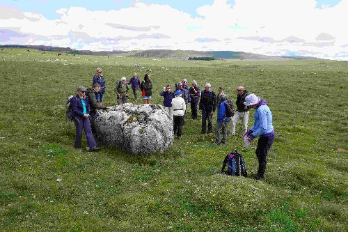
Figure 3

Figure 4.
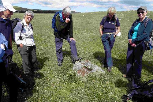
Figure 5.
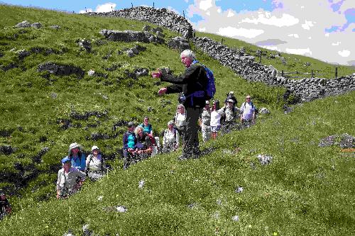
Figure 6.