| JOURNAL 2022 |
| North Craven Heritage Trust |
In the 2020 Journal a letter was published from Frank Peel to P. Hudson (p.8) which says ‘the [retorts] in the river bank are very old, almost certainly from the mid to late 1800s’.
We know the one in St. Alkelda’s churchyard was there in Thomas Brayshaw’s time. The very similar one by the riverside path up from Queens Rock was retrieved from the river by Kevin Harrison and his team when they refurbished the path around 2005. Kevin says it had been in the water since he was a child and it was about 20 metres further upstream from where it is now. This would mean it was not in the existing (Bridge End) weir, but in the remains of the old Kings Mill weir (W R Mitchell says this was washed away in 1950 but much of it still survives in the form of blue slates set vertically in the river bed). I am sure this retort is the one pictured in the 2017 Journal.
A little further upstream, just below the footbridge a set of four or five stone steps (now sadly walled up) leads down to the water. To the side of these steps is another cast iron retort mounted in the bank the opposite way up, with a flange with six bolt holes visible at the top. It looks somewhat reminiscent of the mooring posts often seen along canal towpaths. When the Kings Mill weir was in place the water here would have been deeper and stiller- I wonder if someone had a boat here? If so I would have expected the “mooring post” to be upstream of the steps but it is downstream.
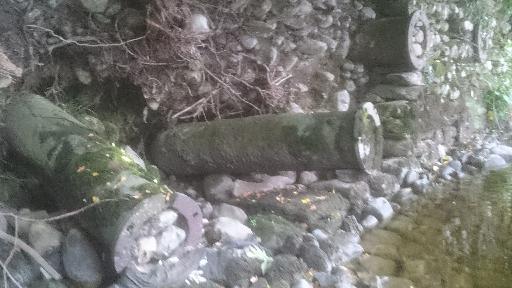
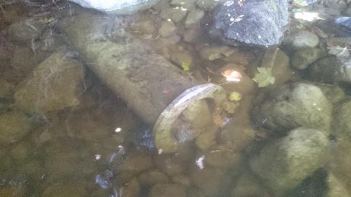
Further upstream at the far end of the football field a trodden path leads from the track to a shingle beach on a bend of the river. Opposite here the Langcliffe road passes close to the river on a bank high above it. Built into the wall of this bank, with their flanges facing outward, are another sixteen or seventeen of these cast iron retorts (Fig 1). At first glance they look like drains to let rainwater through, but the two most upstream have washed loose and there is another lying loose on the river bed (Fig 2). They clearly have a flanged end and a domed end that would not let water through. They all have the six-bolt pattern on their flanges and some are badly distorted, presumably by heat during the gas-making process. I think these are the retorts Frank Peel was refering to.
The loose retorts measure about 6 ft 6 inches long, meaning that Kevin’s is set around two and a half feet into the ground and the “mooring post”, if complete, is set about five feet into the river bank- easily enough to secure a small rowing boat!
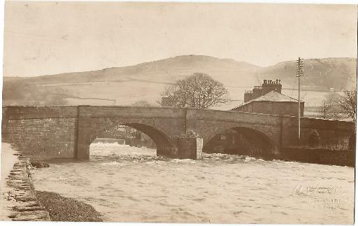
I think Kevin’s and the mooring post were washed out of this bank at some time, perhaps before the construction of Bridge End weir but clearly not before that of the Kings Mill one. A postcard bearing a picture embossed with A Horner of New Street (in 1898 Anthony moved the business to New Street, now Station Road) shows the river bank without the steps or mooring post, with Bridge End weir present but no salmon pass (Fig 3). The salmon pass was added in 1959. W R Mitchell states that ‘from 1830 until 1865 no weirs existed at Settle and Langcliffe’.
Richard Hoyle states that the stump in St Alkelda’s was refered to in July 1845. For it to have been relegated to this position by then, the retorts must almost certainly be from the 1824 attempt to light Settle with vegetable gas. At least twenty retorts, with some showing severe distortion due to heat, would seem to indicate that this venture was more extensive than previously reported.
References
- NCHT Journal 2016, 2017, 2020
- W R Mitchell, A Popular History of Settle and Giggleswick. Castleberg (1993).