| JOURNAL 1994 |
| North Craven Heritage Trust |
4 April 1993
LeaderŚEnid Parker
Meeting PlaceŚHelwith Bridge
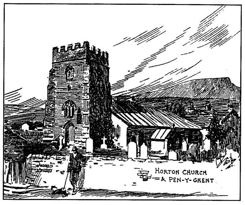
A party of fourteen, plus dogs, met at Helwith Bridge on a sunny dayŚa great asset for a walk commanding fine panoramic views.
We walked along Long Lane, meeting mountain bikers coming down from Pen-y-ghent. Leaving the lane we walked down over the pastures to Dub Cote Farm, passing the camping barn, and on to Brackenbottom.
We heard a graphic description of Douk Ghyll resurgence in flood as we approached Horton-in-Ribblesdale, but there was little water on this spring day. Then we crossed the fields to Brants Gill resurgence. It was new to some of our party, who found the outpouring of water from the potholes on the flanks of Pen-y-ghent a most impressive sight.
We returned along Harber Lane to Horton and followed the Ribble bank downstream to Helwith Bridge.
Wallers in the past did not transport stone very far. The change in walling stone was noticeable as we approached the Helwith flagstone outcropping before returning to our cars at the bridge.
Enid Parker.
2 May 1993
LeaderŚLen Moody
Meeting PlaceŚGiggleswick Station Car Park
GoalŚResting Stone
(Restyngstanes)
Map Ref: SD66/76 756 615
Resting Stone, a notable viewpoint for walkers and lovers of the open spaces, is a rocky, gritstone outcrop at the meeting of the boundaries of the five modern parishes of Austwick, Giggleswick, Gisburn, Rathmell and Easington. Long ago it was also one of the boundary points of the mediaeval, perhaps even pre-Conquest, "shires" or "lordships" known as Burton Chase (Ref: Mary Higham, "THE REGIONE UNUTINGA: a pre-Conquest Lordship?" in University of Lancaster Centre for North West Regional Stuthes, No 6, Summer 1992, pp 43-46).
This was a memorable walk, partly on enclosed farm land, partly on open fell. The route is not waymarked at present, but is reasonably negotiable with careful map-reading, using OS Pathfinder Map 650 (High Bentham and Clapham). The itinerary following refers to the principal places en route, without attempting to describe each twist and turn, each detail of interest, each gate, stile or footbridge.
We gathered at Giggleswick Station (British Rail), equally convenient for those arriving by road or rail, with the Old Station Hotel just opposite across the busy A65. Facing away from Settle and Giggleswick, we dived through the tunnel under the "Little north-western line", followed the road along past Swawbeck House, and branched left over Storth Gill Bridge. About 300 yards on, we took the right of way half left over the fields, passing through Farther Rome and on to Lower Wham, where we followed Wham Lane on to Sandford (Farm). There we turned left with the road, and after about 300 yards turned off right (south west) on a rough moorland track, once leading to a shooting lodge (now disused) and line of grouse butts (ditto). The track gradually becomes indistinct, but we skirted Big Hill and Foxholes Crag, crossed the infant Dub Beck, and set a course westwards until the long low shape of Resting Stone came unmistakably into view, at the north east corner of the Forestry Commission Gisburn Forest.
Resting Stone is indeed a good place for a rest, and one can linger there, examining the various inscriptions in the rock, or just "looking around". If there is time it is fascinating to follow the old boundary line further westwards, searching for the old B S's as marked on the Pathfinder Map, and noting the inscriptions on each side.However, on this occasion, after a rest, we turned south and navigated ourselves over the section of Gisburn Common towards the corner of the Forest north of Brown Hills, and then southwards along the edge of the plantation. We were looking out for a clump of trees standing away from the Forest and marking the site of a former lodge or farm house (not shown on the Pathfinder), but this was useful to guide us back eastwards between Badger Hill and Bullhurst Pike to the meeting place of several tracks near the tip of Hanover Gill. There we took to the field paths (rights of way) through Higher Winterscale Bank, Low Bank and Low Fold to the tarred road. Almost opposite we followed the footpaths over Cocket Moss, south of Rome Crag and down Cocket Lane (rather badly drained, this!) almost as far as Lumb (former farm). On the near side of Lumb, we followed the footpath and short lane, which soon brought us back to Storth Gill Bridge, and turning right back to Giggleswick Station and/or Tetley's Old Station Hotel!
Total distance: 8 miles (approx.). If planning this walk, preferably choose a day with good visibility.
Len Moody.
6 June 1993:
LeaderŚLesley Todd
Meeting PlaceŚGearstones
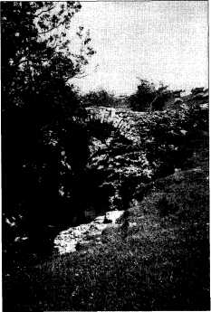
The walk started at Gearstones, a group of buildings on the Hawes road east of Ribblehead. We went through a small wooden gate and crossed fields to the old packhorse bridge over Gayle Beck. From there an indistinct path crosses fields to the now deserted farmhouse at Thorns and then a clearer path across Thorns Moss to Nether Lodge where five tracks meet. We then proceeded via God's Bridge (a large stone forming a natural bridge over Brow Gill beck) to High Birkwith, we turned north and intersected the Pennine Way at Old Ing. This passed Dry Lathe cave and Ling Gill, where we crossed another packhorse bridge with an inscription recording that it was rebuilt in 1765.
This path, after a hot push uphill, intersects with the Dalesway and we turned to meet with the Hawes road about a mile east of Gearstones.
It was a very hot afternoon in mid June yet until we joined the Dalesway we encountered no other walkers although we were on rights of way within sight of the Three Peaks all the time.
Lesley Todd.
5 September 1993
LeaderŚEnid Parker
Meeting PlaceŚHigh Birkwith
Helen and Arthur Lupton, who were to have led this walk, were called away on family businessŚthe birth of a granddaughter!
Five of us followed the track to Nether Lodge. The water was very low at Gods Bridge allowing some of our party to scramble through.
From Nether Lodge we took the Cam Fell route as far as Ling Gill Bridge. While we were deciphering the inscription on the bridge which was "Repaired at the charge of the whole West Riding in 1765", we were surprised to meet several motor cyclists on this well-walked route.
It was a grey dull day but Ling Gill Nature Reserve was ablaze with late summer flowers.
There was great activity above and below ground, the paragliders over the shoulder of Ingleborough and equally colourful potholers around Calf Holes.
We returned along the old pack horse route to High Birkwith, once an inn victualling drovers and packmen on the road from Askrigg to London. Enid Parker.
3 October 1993:
LeaderŚBrenda Capstick
Meeting PlaceŚThornton-in-Lonsdale Church
A lovely sunny autumn day for what proved to be a search for mills, watercourses and Sherlock Holmes along the western limits of our area. From Thornton we crossed the fields and then the A65 to Lower Westhouse, where we stopped to admire the datestone of 1725 on The Trees, a house built for the Burrows family who operated a cotton mill in Westhouse which at the beginning of the 19th century probably employed over 100 workers. Only a barn and two cottages remain. We stopped to read the plaque on a house commemorating its purchase with a bequest from William Slade of Walcot Place, Lambeth.
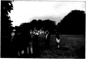
A curious group of us trying to trace the evolution of Westhouse Lodge were enlightened by its resident, Canon Hunter, who kindly came out to talk to us. We then followed the old railway line to Bedleber Mill. This had been powered by a mill race which led water from the high slopes of Gregareth to the N E in an elaborate cut only to be bisected by the construction of the railway. Crossing the A65 again, we made our way to Masongill where Mary Wilson read out a description of Baskerville Hall which is said to have been identified by Sherlock Holmes enthusiasts with Masongill House. The Doyle family lived in Masongill Cottage, where Conan Doyle often visited his mother, and were friends of the family who lived in the big house. We returned to Thornton via Fellside, Ellerbeck and Bank House. A longer walk than intended but with plenty of curiosities on the way.
Brenda Capstick.
7 November 1993
LeadersŚMr and Mrs J. McGeoch
Meeting PlaceŚHellifield
On the first Sunday of November '93, Mr and Mrs McGeoch led a walk from Hellifield. This was a circular route using tracks and field paths around Hellifield and Newton moor.
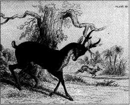
Twelve people set off from the car park at 1.45 pm crossing the A65 and turning up Haw Grove to the railway crossing. Then along to the end of Haw Lane and across the field turning left around the copse and up the hill to the head of Langber Lane. Good views of Sharp Haw and the Aire valley to the east, Pendle Hill and the Ribble valley to the south and Rye Loaf Hill to the north were enjoyed. We continued along Langber Lane to Bookilber barn then turned left across the moor and into Newton Gill. Here we saw interesting rock formations in the exposed shale followed by a gulley with exposed limestone before reverting to the local millstone. Some of us, who were making less noise than the others, caught sight of a deer as we came down to the bridge. We followed the stream down to Little Newton farm then turned left across fields, under the railway bridge and back to the village.
The walk concluded at approx. 4.30 pm as dusk fell on a dull but dry and pleasant day.
John and Jeanette McGeogh.
5 December 1993:
LeaderŚPhyllis Houlton
Meeting PlaceŚGreenfoot Car Park, Settle
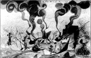
We left Greenfoot car park by Watery Lane past the watercress stream running down the middle of the road, and beyond to Brockholes entering by a stone stile next to a wooden gate side. Walking diagonally across the steep sided field to the far corner we paused for breath and looked back across Settle to Giggleswick Scar, Rathmell Moor and Whelpstone. Following the footpath over stiles and along the limestone slopes we crossed a stream tumbling its way down to the Ribble in the valley bottom. Then we came to the Lodge. This dates back to Doomsday and for many years was the home of the gamekeeper for Anley where the hunting dogs were kept. We disturbed some pheasants, the males flying off showing their colourful plumage and the females running down the field. At the end of the lane we crossed an old road (formerly a coaching road to Clitheroe, which in the valley, fords the Ribble at Runley Bridge) and into a large field at the far side of which is Cleatop wood. About fifty yards above the wood is the site of an old stone circle, possibly of Druid or other ancient originŚ but we could not find any sign of it. Near the top of the wood we climbed over the stile and followed a path between the trees, mainly larch, smelling of damp leaves and late autumn and conveying a promise of spring primroses and bluebells. At the far side of the wood we crossed the stream in a ravine by a wooden bridge and passed over a stile in the wall. Here at Mearbeck, we turned left up the grassy cart track following a well worn track uphill. This leads over peaty moorland, heather and gritstone onto Long Preston moor with views towards Airton and later of Attermire Scar. We descended steeply back into Settle as dark was falling to hot drinks and mince pies and a short review of the past year's walks and ideas for the future.
Phyllis Houlton.
J1994p10_19_files/tmp6FA-2.jpg
Horton Church and Pen-y-Ghent

J1994p10_19_files/tmp6FA-3.jpg
tmp6FA-3.jpg
Burton Chase, from Mary Higham "The Regione
Dunutinga: a pre-Conquest Lordship?" in Centre for
North West Regional Stuthes, University of Lancaster.
J1994p10_19_files/tmp6FA-4.jpg
Resting Stone, Pathfinder SD 66/76 756 615. PhotoŚauthor.
J1994p10_19_files/tmp6FA-5.jpg
Packhorse Bridge over Gayle Beck. PhotoŚMaureen Ellis.

J1994p10_19_files/tmp6FA-6.jpg
Inscription on Packhorse Bridge. PhotoŚMaureen Ellis.
J1994p10_19_files/tmp6FA-7.jpg
Mary Wilson reading to NCHT walkers at Masongill House. Photo by the author.
J1994p10_19_files/tmp6FA-8.jpg
Muntjak Deer, from The Naturalist's Library, Edinburgh, 1835.
J1994p10_19_files/tmp6FA-9.jpg
Destroying a monolith at Avebury. Sketch by Stukeley, 1724.
This is the method described by Brayshaw for reducing the Cleatop
Circle to walling material.